2026 App
Tally Split AI
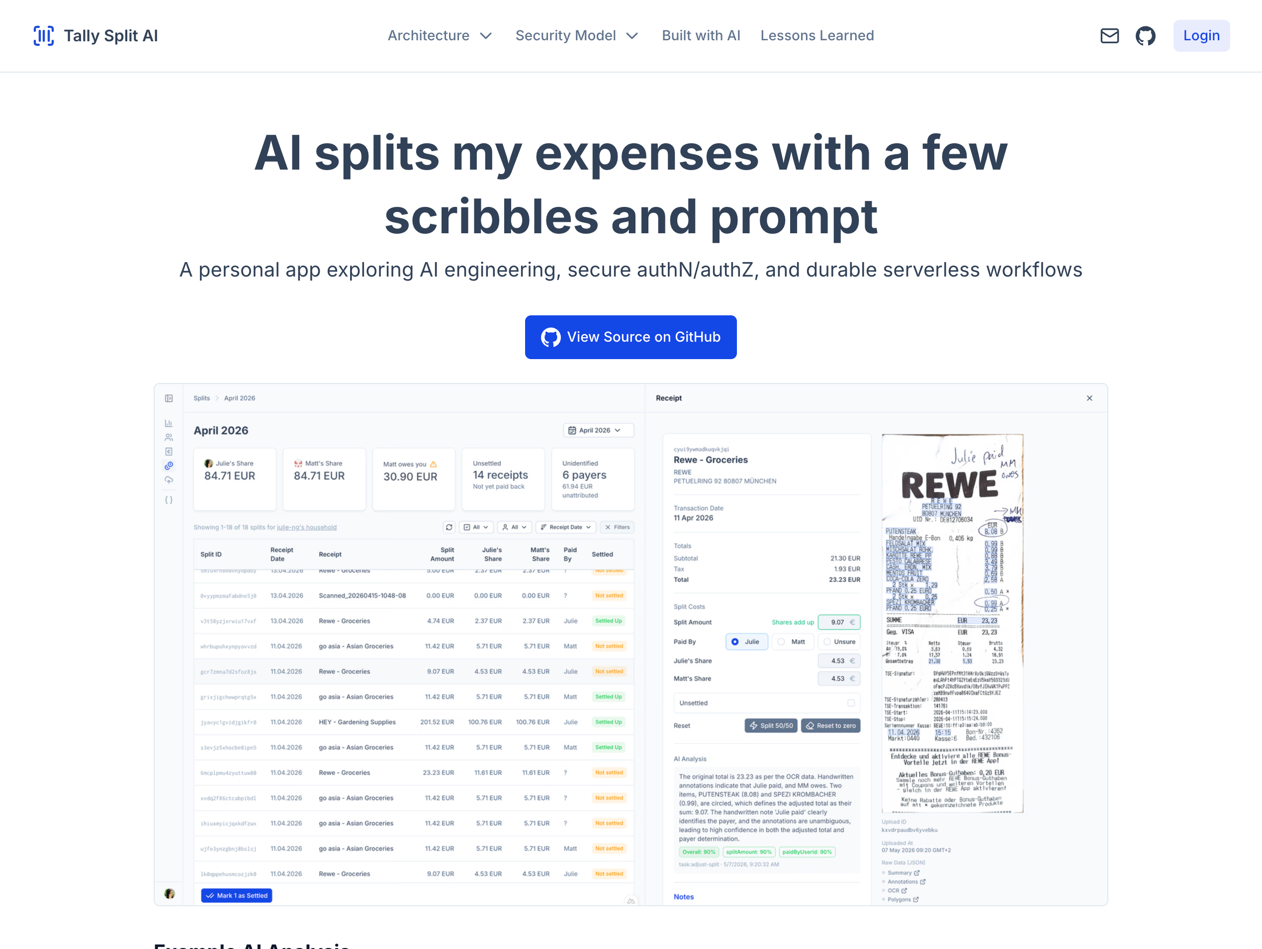
I built an AI app that turns a hand-annotated receipt into a fair split. Underneath the simple idea: a multi-layer LLM pipeline, computer vision for the handwriting, and a custom HMAC security model.
Designing and building sites, tools and apps since I was a kid
Building AI applications end to end, from agentic pipelines to the UX
I built an AI app that turns a hand-annotated receipt into a fair split. Underneath the simple idea: a multi-layer LLM pipeline, computer vision for the handwriting, and a custom HMAC security model.
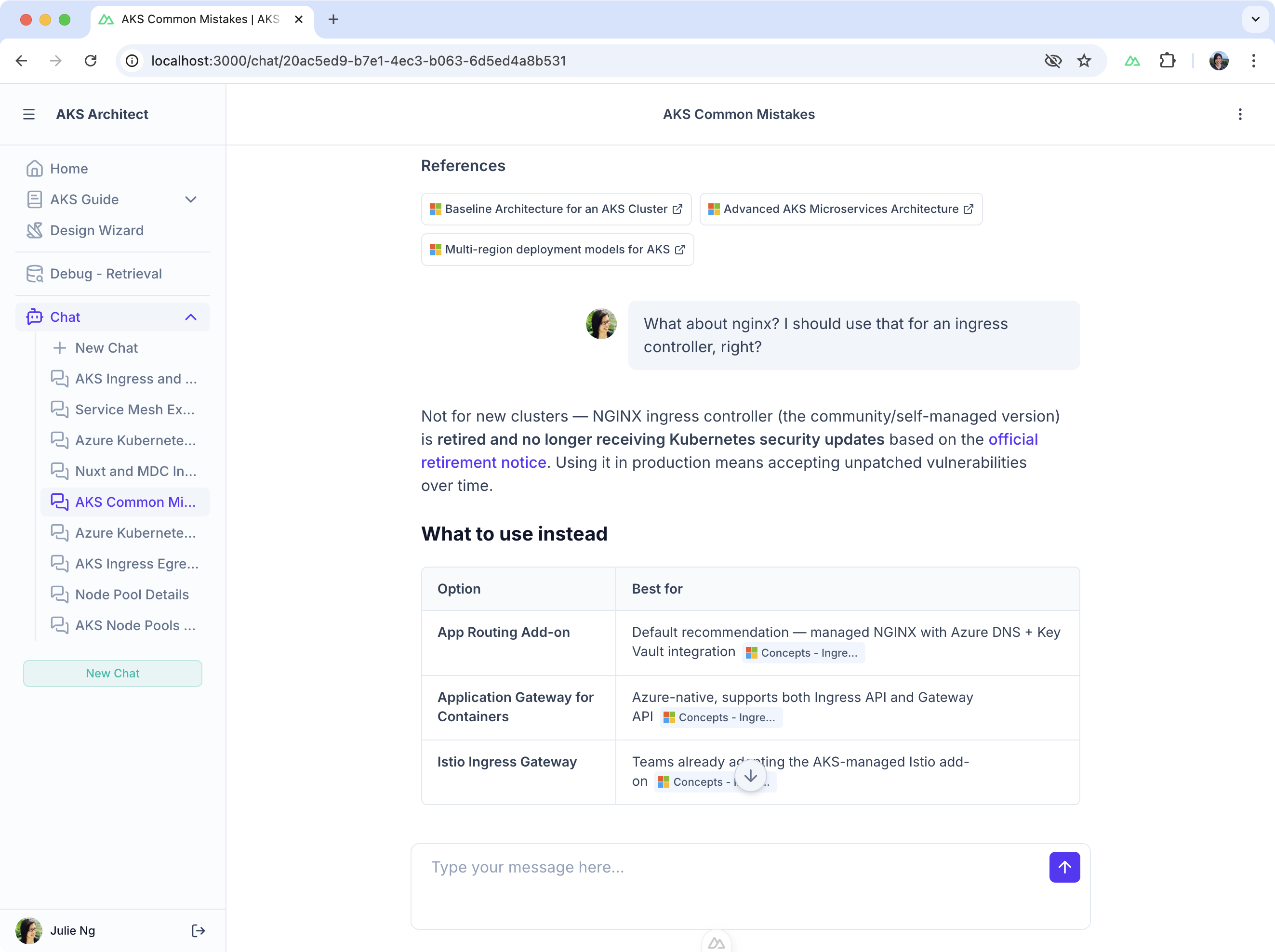
An AI advisor for designing Azure Kubernetes clusters. It blends official Well-Architected best practices and Microsoft docs with guidance personalized to your requirements. I aimed to digitize the version of me that only Microsoft's enterprise clients had access to.
Building beautiful tools to improve the developer experience and workflows
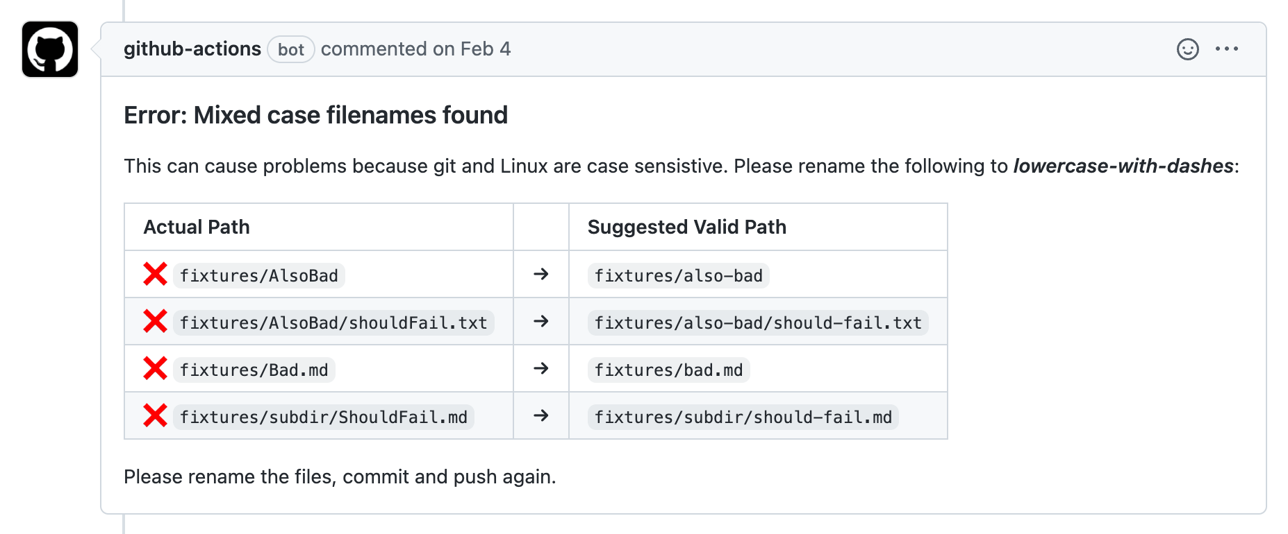
GitHub Action to drive file naming consistency for increased productivity across teams.
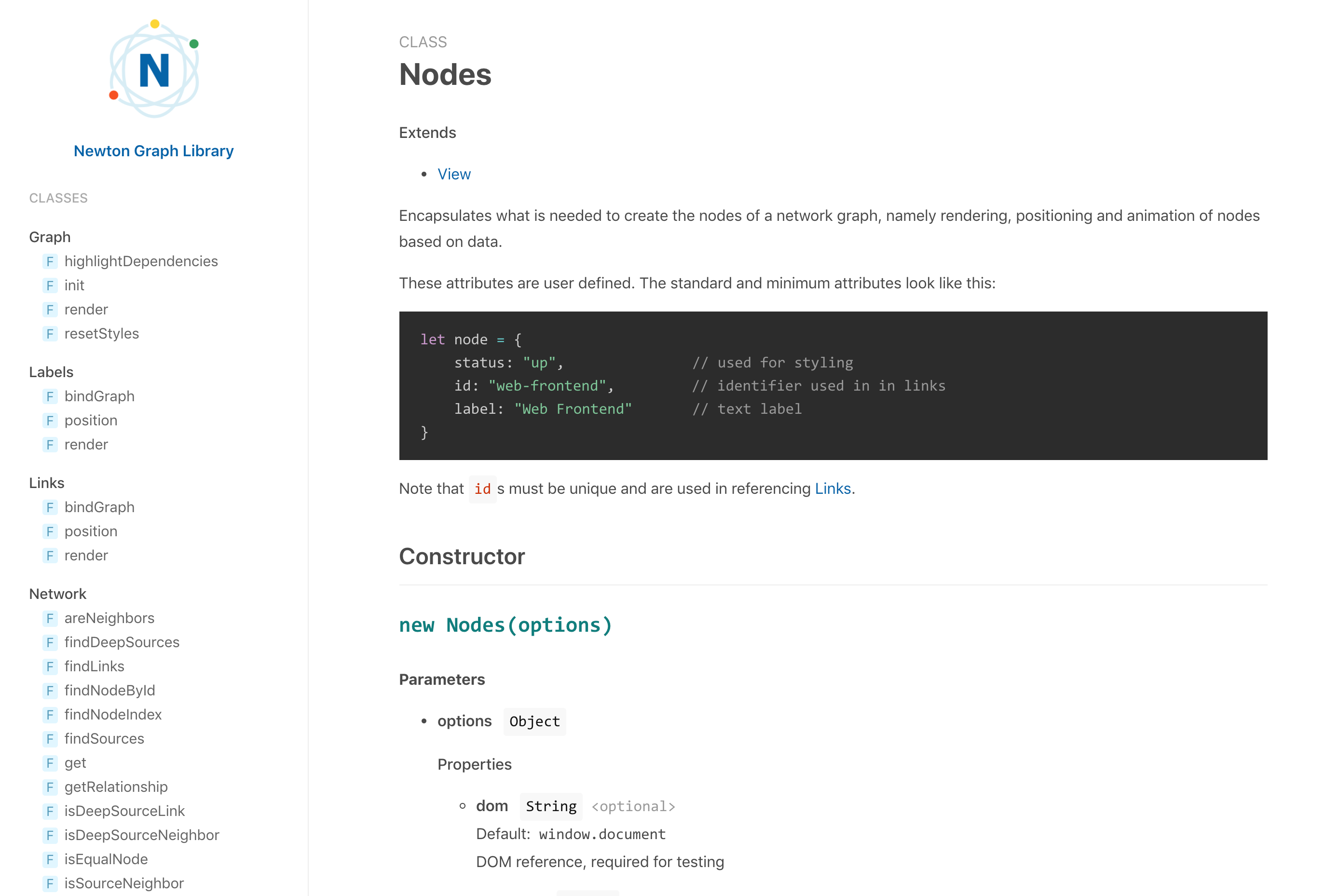
NPM package for a minimalist and clean jsdoc template
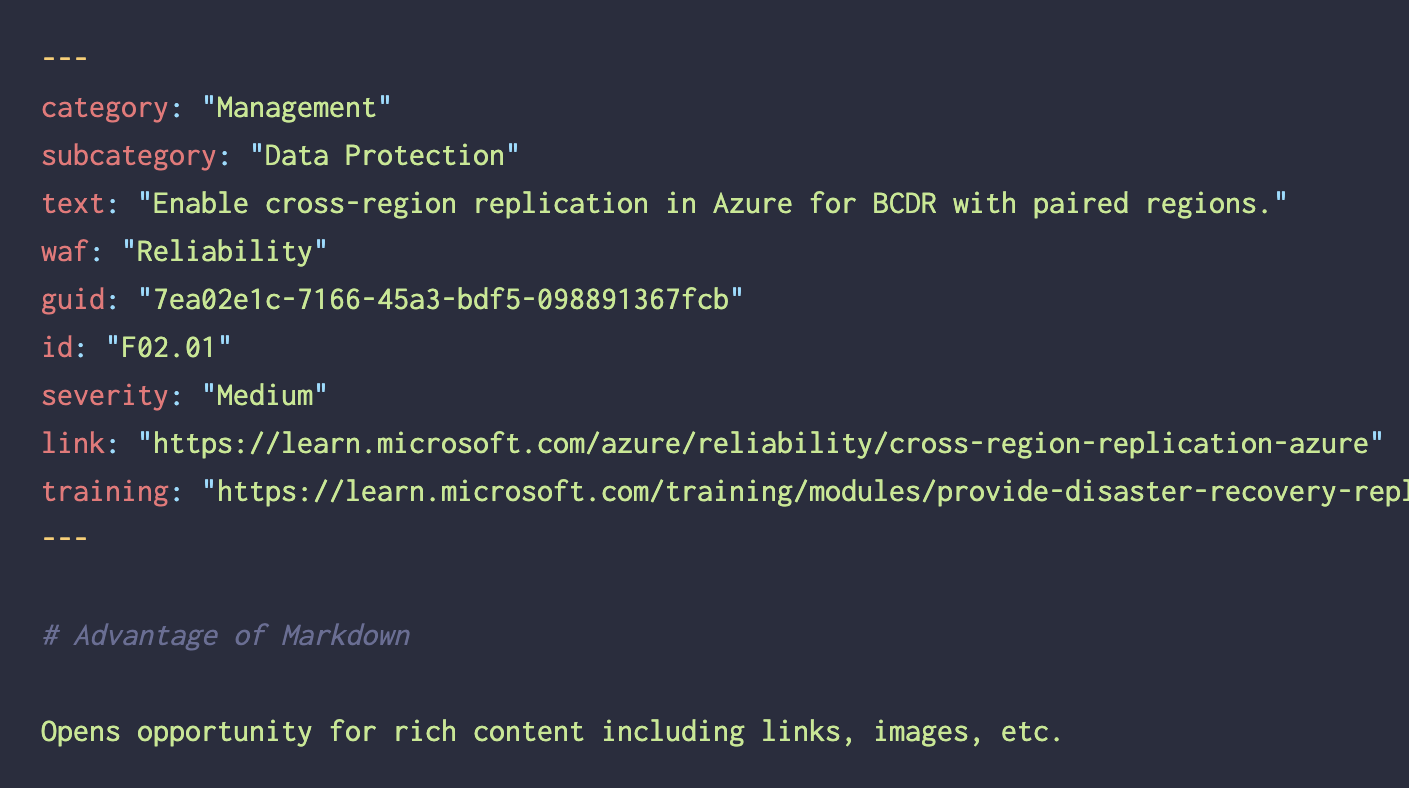
Scripts to convert Azure/review-checklists JSON to Markdown frontmatter.
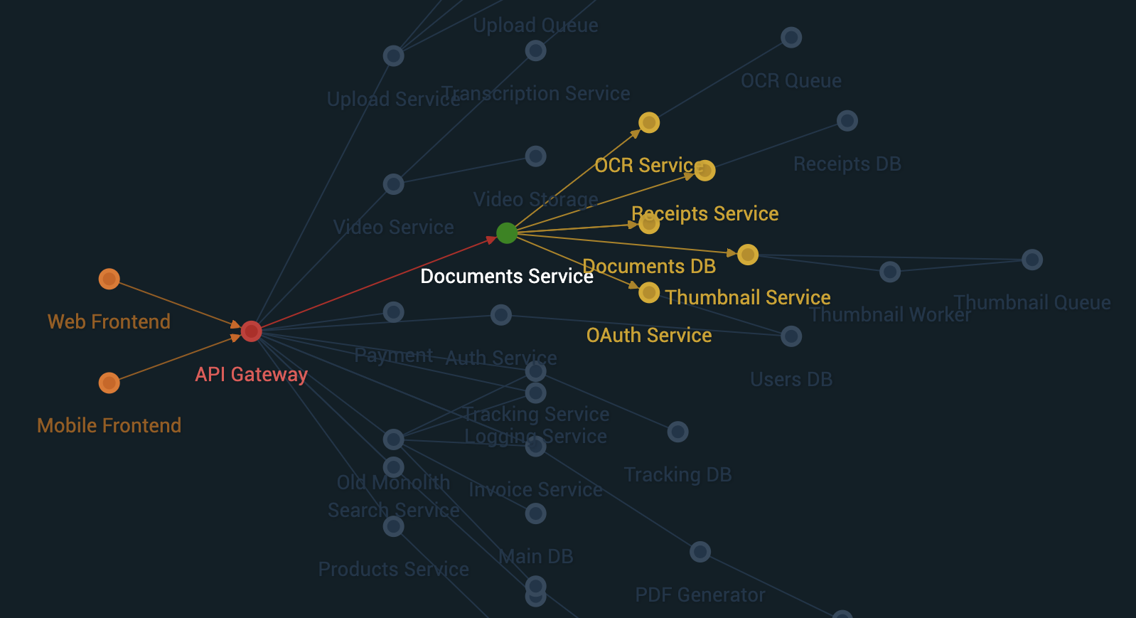
Cloud Architecture Graphs for Humans
Highlights from 25+ year career… starting as a web designer
CLI for automated email development, incl. template generation and inlining CSS
CLI for automated email development, incl. template generation and inlining CSS
Small website for Ancestry.de partner acquisition featuring Google Maps integration.
We conducted user research and decided to counterintuitively increase the number of steps in our onboarding flow to successfully increase new subscriber conversion rate and revenue.
Created a start your family tree wizard in Flash that integrates family name facts and basic search results.
Branded microsite & Document Viewer (Flash) for Bavarian War Rosters from WWI collection launch.
Small website about various groups that emigrated to the U.S.
Branded microsite for launch of Telephone books collection.
Localized a ca. 9MB U.S. video with a custom built Flash slideshow for four European markets.
Website and Poster for the Student Symposium of the conference.
Website for assignments, handouts, images, etc. of art history course at Boston Latin.
My friends and I created a Seevak project on Dorothy Day and placed first.
Custom bulletin board software for Boston Latin School.
A clean typography-based redesign of the Seevak Website Competition pages.
Wordpress design and template development.